 vesseltracker.com
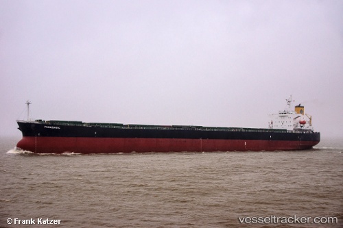
Vessel Panasiatic IMO: 9310276, MMSI: 538005231 Bulk Carrier
UTC, -29.38534, 32.25218, course: 55, speed: 9.3
UTC, -29.20328, 32.51619, course: 40, speed: 9.4
2026-02-19 18:20:03 UTC, -28.86225, 32.87599, course: 40, speed: 9.6
Live AIS position:
UTC. 39 nm E of Richards Bay),
updated 2026-02-19 18:20:03 UTC.
Find the position of the vessel Panasiatic on the map. The latter are known coordinates and path.
marine traffic ship tracker show on live map
The current position of vessel Panasiatic is -28.86225 lat / 32.87599 lng. Updated: 2026-02-19 18:20:03 UTCCurrently sailing under the flag of Marshall Is
Panasiatic built in 2005 year
Deadweight:
82962 tDetails:
Last coordinates of the vessel:
UTC, -29.53406, 31.91600, course: 57, speed: 9.7UTC, -29.38534, 32.25218, course: 55, speed: 9.3
UTC, -29.20328, 32.51619, course: 40, speed: 9.4
2026-02-19 18:20:03 UTC, -28.86225, 32.87599, course: 40, speed: 9.6