 vesseltracker.com
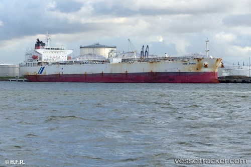
Vessel Sand Shiner IMO: 9351440, MMSI: 538005358 Crude Oil Tanker
UTC, 11.75178, 101.45625, course: 163, speed: 9
UTC, 11.48026, 101.52534, course: 170, speed: 8.9
2026-02-01 01:46:25 UTC, 11.26308, 101.60222, course: 164, speed: 8.6
Live AIS position:
UTC. 48 nm N of Benchamas),
updated 2026-02-01 01:46:25 UTC.
Find the position of the vessel Sand Shiner on the map. The latter are known coordinates and path.
marine traffic ship tracker show on live map
The current position of vessel Sand Shiner is 11.26308 lat / 101.60222 lng. Updated: 2026-02-01 01:46:25 UTCDetails:
Last coordinates of the vessel:
UTC, 12.14879, 101.35390, course: 158, speed: 8.8UTC, 11.75178, 101.45625, course: 163, speed: 9
UTC, 11.48026, 101.52534, course: 170, speed: 8.9
2026-02-01 01:46:25 UTC, 11.26308, 101.60222, course: 164, speed: 8.6