 vesseltracker.com
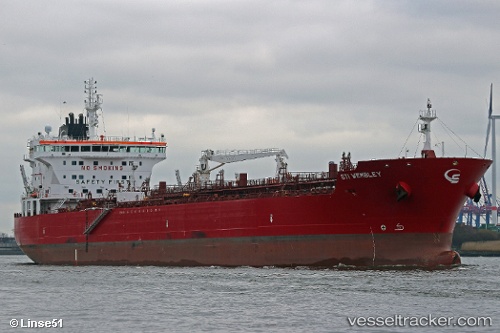
Vessel Sti Wembley IMO: 9691735, MMSI: 538005404 Chemical Oil Products Tanker
UTC, 53.63044, -0.16323, course: 292, speed: 0
UTC, 53.63040, -0.16321, course: 292, speed: 0
2026-01-31 19:32:38 UTC, 53.63042, -0.16318, course: 292, speed: 0
Live AIS position:
UTC. Near Immingham),
updated 2026-01-31 19:32:38 UTC.
Find the position of the vessel Sti Wembley on the map. The latter are known coordinates and path.
marine traffic ship tracker show on live map
The current position of vessel Sti Wembley is 53.63042 lat / -0.16318 lng. Updated: 2026-01-31 19:32:38 UTCCurrently sailing under the flag of Marshall Is
Details:
Last coordinates of the vessel:
UTC, 53.63044, -0.16321, course: 292, speed: 0UTC, 53.63044, -0.16323, course: 292, speed: 0
UTC, 53.63040, -0.16321, course: 292, speed: 0
2026-01-31 19:32:38 UTC, 53.63042, -0.16318, course: 292, speed: 0