 vesseltracker.com
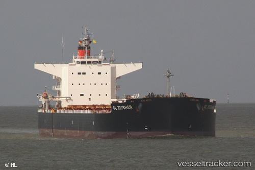
Vessel Amami IMO: 9520821, MMSI: 538005470 Bulk Carrier
UTC, 48.75138, -123.59664, course: 140, speed: 0
UTC, 48.75140, -123.59699, course: 142, speed: 0
2026-03-15 23:21:03 UTC, 48.75107, -123.59704, course: 127, speed: 0
Live Vessel Amami Analytics (details, animations, etc.)
Live AIS position: UTC. Near Cobble Hill), updated 2026-03-15 23:21:03 UTC.Find the position of the vessel Amami on the map. The latter are known coordinates and path.
marine traffic ship tracker show on live map
The current position of vessel Amami is 48.75107 lat / -123.59704 lng. Updated: 2026-03-15 23:21:03 UTCCurrently sailing under the flag of Marshall Is
Amami built in 2011 year
Deadweight:
98681 tDetails:
Last coordinates of the vessel:
UTC, 48.75100, -123.59252, course: 226, speed: 0.1UTC, 48.75138, -123.59664, course: 140, speed: 0
UTC, 48.75140, -123.59699, course: 142, speed: 0
2026-03-15 23:21:03 UTC, 48.75107, -123.59704, course: 127, speed: 0