 vesseltracker.com
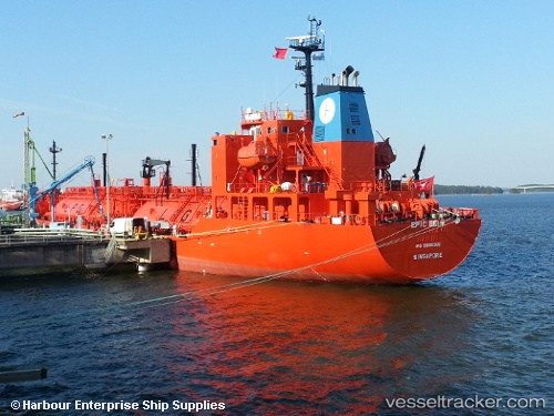
Vessel ECO STREAM IMO: 9698355, MMSI: 538005492 LPG Tanker
UTC, 28.14642, -15.41019, course: 182, speed: 2.9
UTC, 27.98880, -15.26431, course: 138, speed: 14
2026-01-14 19:53:04 UTC, 27.80500, -15.24614, course: 192, speed: 14.3
Live AIS position:
UTC. Near Cruce Arinaga),
updated 2026-01-14 19:53:04 UTC.
Find the position of the vessel ECO STREAM on the map. The latter are known coordinates and path.
marine traffic ship tracker show on live map
The current position of vessel ECO STREAM is 27.80500 lat / -15.24614 lng. Updated: 2026-01-14 19:53:04 UTCCurrently sailing under the flag of Marshall Islands
ECO STREAM built in 2014 year
Deadweight:
5872 tDetails:
Last coordinates of the vessel:
UTC, 28.14500, -15.40667, course: -1, speed: 0UTC, 28.14642, -15.41019, course: 182, speed: 2.9
UTC, 27.98880, -15.26431, course: 138, speed: 14
2026-01-14 19:53:04 UTC, 27.80500, -15.24614, course: 192, speed: 14.3