 vesseltracker.com
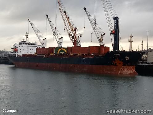
Vessel Roadrunner IMO: 9438042, MMSI: 538005498 Bulk Carrier
UTC, -6.72891, 39.32816, course: 25, speed: 0
UTC, -6.72905, 39.32829, course: 21, speed: 0
2026-03-15 20:04:15 UTC, -6.72875, 39.32802, course: 36, speed: 0
Live Vessel Roadrunner Analytics (details, animations, etc.)
Live AIS position: UTC. Near Dar es Salaam), updated 2026-03-15 20:04:15 UTC.Find the position of the vessel Roadrunner on the map. The latter are known coordinates and path.
marine traffic ship tracker show on live map
The current position of vessel Roadrunner is -6.72875 lat / 39.32802 lng. Updated: 2026-03-15 20:04:15 UTCDetails:
Last coordinates of the vessel:
UTC, -6.72879, 39.32812, course: 26, speed: 0.2UTC, -6.72891, 39.32816, course: 25, speed: 0
UTC, -6.72905, 39.32829, course: 21, speed: 0
2026-03-15 20:04:15 UTC, -6.72875, 39.32802, course: 36, speed: 0