 vesseltracker.com
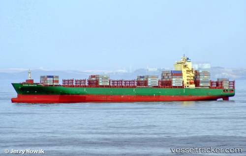
Vessel Maersk Euphrates IMO: 9694567, MMSI: 538005747 Container Ship
UTC, -33.96939, 151.21938, course: 249, speed: 0
UTC, -33.96939, 151.21931, course: 249, speed: 0
2026-01-15 18:09:08 UTC, -33.96940, 151.21935, course: 249, speed: 0
Live AIS position:
UTC. Near BOTANY),
updated 2026-01-15 18:09:08 UTC.
Find the position of the vessel Maersk Euphrates on the map. The latter are known coordinates and path.
marine traffic ship tracker show on live map
The current position of vessel Maersk Euphrates is -33.96940 lat / 151.21935 lng. Updated: 2026-01-15 18:09:08 UTCCurrently sailing under the flag of Marshall Is
Details:
Last coordinates of the vessel:
UTC, -33.96936, 151.21922, course: 249, speed: 0UTC, -33.96939, 151.21938, course: 249, speed: 0
UTC, -33.96939, 151.21931, course: 249, speed: 0
2026-01-15 18:09:08 UTC, -33.96940, 151.21935, course: 249, speed: 0