 vesseltracker.com
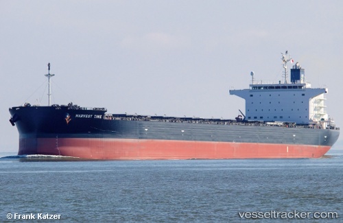
Vessel Harvest Time IMO: 9643881, MMSI: 538006106 Bulk Carrier
UTC, 48.70078, -123.53690, course: 86, speed: 0
UTC, 48.70033, -123.53674, course: 72, speed: 0
2026-01-14 10:09:23 UTC, 48.69922, -123.53374, course: 354, speed: 0
Live AIS position:
UTC. Near Hatch Point),
updated 2026-01-14 10:09:23 UTC.
Find the position of the vessel Harvest Time on the map. The latter are known coordinates and path.
marine traffic ship tracker show on live map
The current position of vessel Harvest Time is 48.69922 lat / -123.53374 lng. Updated: 2026-01-14 10:09:23 UTCCurrently sailing under the flag of Marshall Is
Details:
Last coordinates of the vessel:
UTC, 48.70163, -123.53691, course: 113, speed: 0UTC, 48.70078, -123.53690, course: 86, speed: 0
UTC, 48.70033, -123.53674, course: 72, speed: 0
2026-01-14 10:09:23 UTC, 48.69922, -123.53374, course: 354, speed: 0