 vesseltracker.com
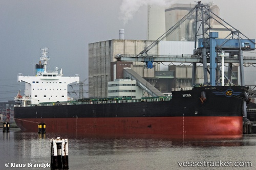
Vessel Myra IMO: 9418456, MMSI: 538006335 Bulk Carrier
UTC, 30.05262, -90.50624, course: 261, speed: 0.1
UTC, 30.05256, -90.50618, course: 269, speed: 0.1
2026-01-14 18:38:26 UTC, 30.05244, -90.50610, course: 271, speed: 0.1
Live AIS position:
UTC. Near Port Of South Louisiana),
updated 2026-01-14 18:38:26 UTC.
Find the position of the vessel Myra on the map. The latter are known coordinates and path.
marine traffic ship tracker show on live map
The current position of vessel Myra is 30.05244 lat / -90.50610 lng. Updated: 2026-01-14 18:38:26 UTCDetails:
Last coordinates of the vessel:
UTC, 30.05269, -90.50620, course: 262, speed: 0UTC, 30.05262, -90.50624, course: 261, speed: 0.1
UTC, 30.05256, -90.50618, course: 269, speed: 0.1
2026-01-14 18:38:26 UTC, 30.05244, -90.50610, course: 271, speed: 0.1