 vesseltracker.com
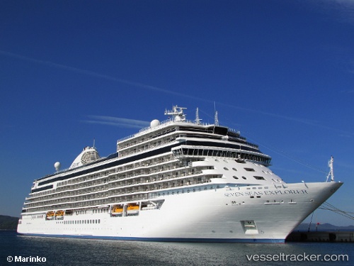
Vessel Seven Seas Explorer IMO: 9703150, MMSI: 538006712 Cruise Ship
UTC, -41.59619, 174.72101, course: 203, speed: 16.3
UTC, -41.65382, 174.68823, course: 200, speed: 16.1
2026-01-16 07:42:48 UTC, -41.96357, 174.48418, course: 206, speed: 15.9
Live AIS position:
UTC. 25 nm SE of Seddon),
updated 2026-01-16 07:42:48 UTC.
Find the position of the vessel Seven Seas Explorer on the map. The latter are known coordinates and path.
marine traffic ship tracker show on live map
The current position of vessel Seven Seas Explorer is -41.96357 lat / 174.48418 lng. Updated: 2026-01-16 07:42:48 UTCDetails:
Last coordinates of the vessel:
UTC, -41.26833, 174.78667, course: -1, speed: 0UTC, -41.59619, 174.72101, course: 203, speed: 16.3
UTC, -41.65382, 174.68823, course: 200, speed: 16.1
2026-01-16 07:42:48 UTC, -41.96357, 174.48418, course: 206, speed: 15.9