 vesseltracker.com
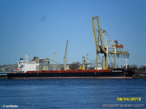
Vessel Texas IMO: 9603063, MMSI: 538006936 Bulk Carrier
UTC, 44.08139, 36.46093, course: 241, speed: 11.4
UTC, 43.91822, 36.02679, course: 239, speed: 11.6
2026-02-06 09:52:06 UTC, 43.66970, 35.67965, course: 206, speed: 11.7
Live AIS position:
UTC. 75 nm S of Ordzhonikidze),
updated 2026-02-06 09:52:06 UTC.
Find the position of the vessel Texas on the map. The latter are known coordinates and path.
marine traffic ship tracker show on live map
The current position of vessel Texas is 43.66970 lat / 35.67965 lng. Updated: 2026-02-06 09:52:06 UTCDetails:
Last coordinates of the vessel:
UTC, 44.57753, 38.13388, course: 245, speed: 52.3UTC, 44.08139, 36.46093, course: 241, speed: 11.4
UTC, 43.91822, 36.02679, course: 239, speed: 11.6
2026-02-06 09:52:06 UTC, 43.66970, 35.67965, course: 206, speed: 11.7