 vesseltracker.com
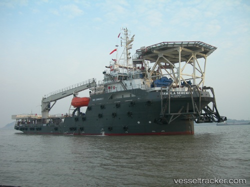
Vessel Mamola Serenity IMO: 9562647, MMSI: 538006964 Offshore Tug Supply Ship
UTC, -33.91690, 18.43988, course: 134, speed: 0
UTC, -33.91687, 18.43990, course: 134, speed: 0
2026-03-24 08:10:18 UTC, -33.91687, 18.43985, course: 134, speed: 0
Live Vessel Mamola Serenity Analytics (details, animations, etc.)
Live AIS position: UTC. Near Ben Schoeman Dock), updated 2026-03-24 08:10:18 UTC.Find the position of the vessel Mamola Serenity on the map. The latter are known coordinates and path.
marine traffic ship tracker show on live map
The current position of vessel Mamola Serenity is -33.91687 lat / 18.43985 lng. Updated: 2026-03-24 08:10:18 UTCCurrently sailing under the flag of Marshall Is
Details:
Last coordinates of the vessel:
UTC, -33.91687, 18.43992, course: 134, speed: 0UTC, -33.91690, 18.43988, course: 134, speed: 0
UTC, -33.91687, 18.43990, course: 134, speed: 0
2026-03-24 08:10:18 UTC, -33.91687, 18.43985, course: 134, speed: 0