 vesseltracker.com
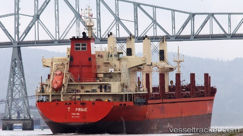
Vessel T Prime IMO: 9611503, MMSI: 538007082 Bulk Carrier
UTC, -39.22230, 148.24916, course: 231, speed: 11.1
UTC, -39.40232, 147.82053, course: 243, speed: 12.2
2026-01-18 20:44:07 UTC, -39.43447, 147.73947, course: 244, speed: 12.4
Live AIS position:
UTC. 52 nm NW of FLINDERS ISLAND),
updated 2026-01-18 20:44:07 UTC.
Find the position of the vessel T Prime on the map. The latter are known coordinates and path.
marine traffic ship tracker show on live map
The current position of vessel T Prime is -39.43447 lat / 147.73947 lng. Updated: 2026-01-18 20:44:07 UTCCurrently sailing under the flag of Marshall Is
T Prime built in 2011 year
Deadweight:
32451 tDetails:
Last coordinates of the vessel:
UTC, -39.16845, 148.34573, course: 231, speed: 11.2UTC, -39.22230, 148.24916, course: 231, speed: 11.1
UTC, -39.40232, 147.82053, course: 243, speed: 12.2
2026-01-18 20:44:07 UTC, -39.43447, 147.73947, course: 244, speed: 12.4