 vesseltracker.com
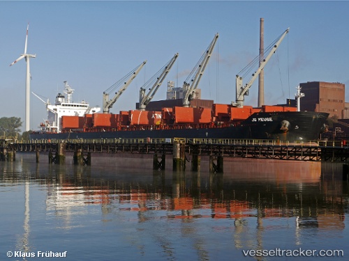
Vessel Mariman IMO: 9575175, MMSI: 538007141 Bulk Carrier
UTC, 21.68215, 72.50933, course: 176, speed: 0.1
UTC, 21.68217, 72.50933, course: 176, speed: 0.1
2026-03-10 07:31:25 UTC, 21.68219, 72.50932, course: 176, speed: 0
Live Vessel Mariman Analytics (details, animations, etc.)
Live AIS position: UTC. Near DAHEJ), updated 2026-03-10 07:31:25 UTC.Find the position of the vessel Mariman on the map. The latter are known coordinates and path.
marine traffic ship tracker show on live map
The current position of vessel Mariman is 21.68219 lat / 72.50932 lng. Updated: 2026-03-10 07:31:25 UTCCurrently sailing under the flag of Marshall Is
Mariman built in 2012 year
Deadweight:
63500 tDetails:
Last coordinates of the vessel:
UTC, 21.68215, 72.50930, course: 175, speed: 0UTC, 21.68215, 72.50933, course: 176, speed: 0.1
UTC, 21.68217, 72.50933, course: 176, speed: 0.1
2026-03-10 07:31:25 UTC, 21.68219, 72.50932, course: 176, speed: 0