 vesseltracker.com
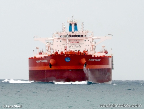
Vessel Nordic Thunder IMO: 9797228, MMSI: 538007379 Crude Oil Tanker
UTC, 45.57272, -61.34378, course: 323, speed: 0
UTC, 45.57272, -61.34377, course: 323, speed: 0
2026-02-12 10:15:24 UTC, 45.57270, -61.34378, course: 323, speed: 0
Live AIS position:
UTC. Near Point Tupper),
updated 2026-02-12 10:15:24 UTC.
Find the position of the vessel Nordic Thunder on the map. The latter are known coordinates and path.
marine traffic ship tracker show on live map
The current position of vessel Nordic Thunder is 45.57270 lat / -61.34378 lng. Updated: 2026-02-12 10:15:24 UTCCurrently sailing under the flag of Marshall Is
Details:
Last coordinates of the vessel:
UTC, 45.57271, -61.34379, course: 323, speed: 0UTC, 45.57272, -61.34378, course: 323, speed: 0
UTC, 45.57272, -61.34377, course: 323, speed: 0
2026-02-12 10:15:24 UTC, 45.57270, -61.34378, course: 323, speed: 0