 vesseltracker.com
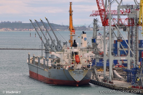
Vessel Geki Star IMO: 9470844, MMSI: 538007470 Bulk Carrier
UTC, 42.22123, -8.86902, course: 231, speed: 0.1
UTC, 42.22113, -8.86892, course: 236, speed: 0.1
2026-01-29 03:50:37 UTC, 42.22142, -8.86937, course: 234, speed: 0
Live AIS position:
UTC. Near CANGAS),
updated 2026-01-29 03:50:37 UTC.
Find the position of the vessel Geki Star on the map. The latter are known coordinates and path.
marine traffic ship tracker show on live map
The current position of vessel Geki Star is 42.22142 lat / -8.86937 lng. Updated: 2026-01-29 03:50:37 UTCDetails:
Last coordinates of the vessel:
UTC, 42.22187, -8.87000, course: 208, speed: 0UTC, 42.22123, -8.86902, course: 231, speed: 0.1
UTC, 42.22113, -8.86892, course: 236, speed: 0.1
2026-01-29 03:50:37 UTC, 42.22142, -8.86937, course: 234, speed: 0