 vesseltracker.com
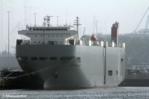
Vessel Eastern Highway IMO: 9325764, MMSI: 538007611 Vehicles Carrier
UTC, 24.99660, 55.08014, course: 316, speed: 0
UTC, 24.99658, 55.08016, course: 316, speed: 0
2026-02-17 13:47:52 UTC, 24.99657, 55.08014, course: 316, speed: 0
Live AIS position:
UTC. Near Jebel Ali Free Zone),
updated 2026-02-17 13:47:52 UTC.
Find the position of the vessel Eastern Highway on the map. The latter are known coordinates and path.
marine traffic ship tracker show on live map
The current position of vessel Eastern Highway is 24.99657 lat / 55.08014 lng. Updated: 2026-02-17 13:47:52 UTCDetails:
Last coordinates of the vessel:
UTC, 24.99657, 55.08015, course: 316, speed: 0UTC, 24.99660, 55.08014, course: 316, speed: 0
UTC, 24.99658, 55.08016, course: 316, speed: 0
2026-02-17 13:47:52 UTC, 24.99657, 55.08014, course: 316, speed: 0