 vesseltracker.com
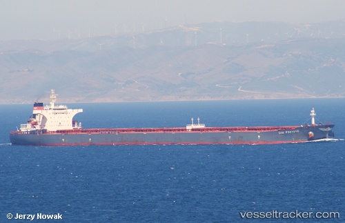
Vessel S Cape IMO: 9255000, MMSI: 538007725 Bulk Carrier
UTC, 69.03135, 33.04040, course: 203, speed: 0
UTC, 69.03135, 33.04040, course: 203, speed: 0
2026-02-20 09:59:31 UTC, 69.03135, 33.04040, course: 203, speed: 0
Live AIS position:
UTC. Near Murmansk),
updated 2026-02-20 09:59:31 UTC.
Find the position of the vessel S Cape on the map. The latter are known coordinates and path.
marine traffic ship tracker show on live map
The current position of vessel S Cape is 69.03135 lat / 33.04040 lng. Updated: 2026-02-20 09:59:31 UTCCurrently sailing under the flag of Marshall Is
S Cape built in 2003 year
Deadweight:
175526 tDetails:
Last coordinates of the vessel:
UTC, 69.03135, 33.04040, course: 203, speed: 0UTC, 69.03135, 33.04040, course: 203, speed: 0
UTC, 69.03135, 33.04040, course: 203, speed: 0
2026-02-20 09:59:31 UTC, 69.03135, 33.04040, course: 203, speed: 0