 vesseltracker.com
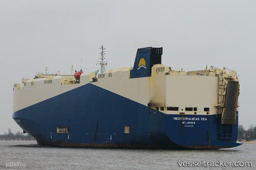
Vessel Mediterranean Sea IMO: 9451006, MMSI: 538007768 Vehicles Carrier
UTC, 34.11672, -119.21041, course: 4, speed: 0.1
UTC, 34.11659, -119.21111, course: 343, speed: 0.1
2026-01-29 07:41:17 UTC, 34.11674, -119.21140, course: 1, speed: 0
Live AIS position:
UTC. Near Port Hueneme),
updated 2026-01-29 07:41:17 UTC.
Find the position of the vessel Mediterranean Sea on the map. The latter are known coordinates and path.
marine traffic ship tracker show on live map
The current position of vessel Mediterranean Sea is 34.11674 lat / -119.21140 lng. Updated: 2026-01-29 07:41:17 UTCCurrently sailing under the flag of Marshall Is
Mediterranean Sea built in 2010 year
Deadweight:
14774 tDetails:
Last coordinates of the vessel:
UTC, 34.11662, -119.21085, course: 296, speed: 0.1UTC, 34.11672, -119.21041, course: 4, speed: 0.1
UTC, 34.11659, -119.21111, course: 343, speed: 0.1
2026-01-29 07:41:17 UTC, 34.11674, -119.21140, course: 1, speed: 0