 vesseltracker.com
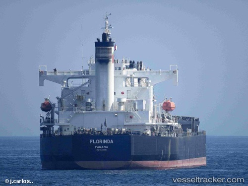
Vessel FLORINDA IMO: 9423499, MMSI: 538008253 Bulk Carrier
UTC, 31.47833, 121.41333, course: -1, speed: 0
UTC, 31.47890, 121.41463, course: 307, speed: 0
2026-03-02 03:23:00 UTC, 31.47894, 121.41463, course: 308, speed: 0
Live AIS position:
UTC. Near Baoshan Pt),
updated 2026-03-02 03:23:00 UTC.
Find the position of the vessel FLORINDA on the map. The latter are known coordinates and path.
marine traffic ship tracker show on live map
The current position of vessel FLORINDA is 31.47894 lat / 121.41463 lng. Updated: 2026-03-02 03:23:00 UTCCurrently sailing under the flag of Marshall Islands
FLORINDA built in 2008 year
Deadweight:
58791 tDetails:
Last coordinates of the vessel:
UTC, 31.47890, 121.41465, course: 307, speed: 0UTC, 31.47833, 121.41333, course: -1, speed: 0
UTC, 31.47890, 121.41463, course: 307, speed: 0
2026-03-02 03:23:00 UTC, 31.47894, 121.41463, course: 308, speed: 0