 vesseltracker.com
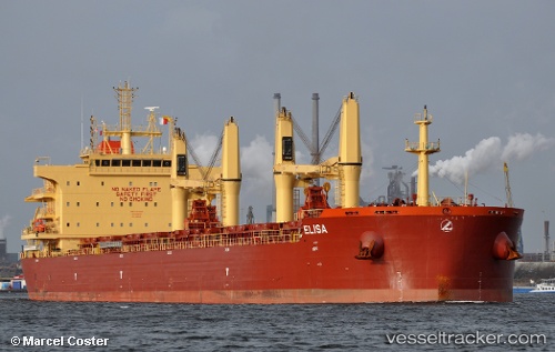
Vessel ELISA IMO: 9730232, MMSI: 538008573 Bulk Carrier
UTC, 1.24029, 103.39605, course: 309, speed: 11.7
UTC, 1.38612, 103.21451, course: 300, speed: 12
2026-02-22 19:31:00 UTC, 1.61471, 102.91302, course: 309, speed: 13.5
Live AIS position:
UTC. 19 nm SW of Parit Raja),
updated 2026-02-22 19:31:00 UTC.
Find the position of the vessel ELISA on the map. The latter are known coordinates and path.
marine traffic ship tracker show on live map
The current position of vessel ELISA is 1.61471 lat / 102.91302 lng. Updated: 2026-02-22 19:31:00 UTCCurrently sailing under the flag of Marshall Islands
ELISA built in 2016 year
Deadweight:
58623 tDetails:
Last coordinates of the vessel:
UTC, 1.17201, 103.79727, course: 247, speed: 14.9UTC, 1.24029, 103.39605, course: 309, speed: 11.7
UTC, 1.38612, 103.21451, course: 300, speed: 12
2026-02-22 19:31:00 UTC, 1.61471, 102.91302, course: 309, speed: 13.5