 vesseltracker.com
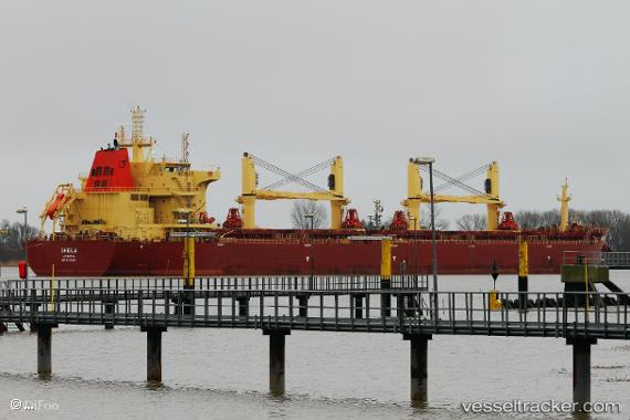
Vessel SHEILA IMO: 9730244, MMSI: 538008574 Bulk Carrier
UTC, 33.89685, 132.59222, course: -1, speed: 13.6
UTC, 33.89685, 132.59222, course: -1, speed: 13.6
2026-03-06 05:33:12 UTC, 33.89685, 132.59222, course: -1, speed: 13.6
Live Vessel SHEILA Analytics (details, animations, etc.)
Live AIS position: UTC. Near TAKAHAMA), updated 2026-03-06 05:33:12 UTC.Find the position of the vessel SHEILA on the map. The latter are known coordinates and path.
marine traffic ship tracker show on live map
The current position of vessel SHEILA is 33.89685 lat / 132.59222 lng. Updated: 2026-03-06 05:33:12 UTCCurrently sailing under the flag of Marshall Islands
SHEILA built in 2016 year
Deadweight:
58608 tDetails:
Last coordinates of the vessel:
UTC, 34.45058, 133.92674, course: -1, speed: 0UTC, 33.89685, 132.59222, course: -1, speed: 13.6
UTC, 33.89685, 132.59222, course: -1, speed: 13.6
2026-03-06 05:33:12 UTC, 33.89685, 132.59222, course: -1, speed: 13.6