 vesseltracker.com
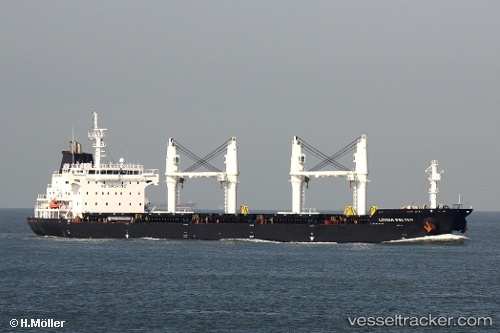
Vessel 'LOUISA BOLTEN' IMO: 9406049, MMSI: 538008683
UTC, 54.45741, 18.66871, course: 108, speed: 0.1
UTC, 54.45759, 18.66884, course: 116, speed: 0
2026-02-01 04:07:53 UTC, 54.45774, 18.66900, course: 122, speed: 0.1
Live AIS position:
UTC. Near Nowy Port/Gdansk),
updated 2026-02-01 04:07:53 UTC.
Find the position of the vessel 'LOUISA BOLTEN' on the map. The latter are known coordinates and path.
marine traffic ship tracker show on live map
The current position of vessel 'LOUISA BOLTEN' is 54.45774 lat / 18.66900 lng. Updated: 2026-02-01 04:07:53 UTCDetails:
Last coordinates of the vessel:
UTC, 54.45744, 18.66872, course: 107, speed: 0.1UTC, 54.45741, 18.66871, course: 108, speed: 0.1
UTC, 54.45759, 18.66884, course: 116, speed: 0
2026-02-01 04:07:53 UTC, 54.45774, 18.66900, course: 122, speed: 0.1