 vesseltracker.com
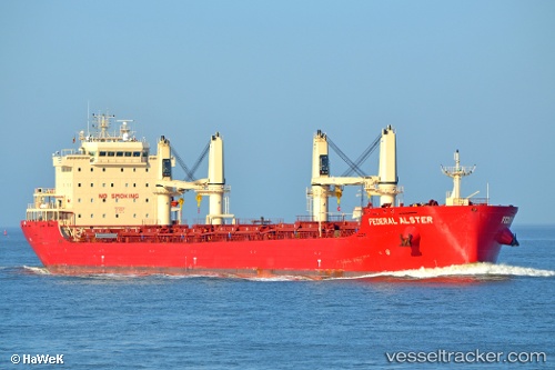
Vessel FEDERAL ALSTER IMO: 9766164, MMSI: 538008901 Bulk Carrier
UTC, 46.40333, -72.37833, course: -1, speed: 0
UTC, 46.40333, -72.37833, course: -1, speed: 0
2026-02-28 13:59:55 UTC, 46.40333, -72.37833, course: -1, speed: 0
Live AIS position:
UTC. Near Champlain),
updated 2026-02-28 13:59:55 UTC.
Find the position of the vessel FEDERAL ALSTER on the map. The latter are known coordinates and path.
marine traffic ship tracker show on live map
The current position of vessel FEDERAL ALSTER is 46.40333 lat / -72.37833 lng. Updated: 2026-02-28 13:59:55 UTCCurrently sailing under the flag of Marshall Islands
FEDERAL ALSTER built in 2016 year
Deadweight:
36583 tDetails:
Last coordinates of the vessel:
UTC, 46.40333, -72.37833, course: -1, speed: 0UTC, 46.40333, -72.37833, course: -1, speed: 0
UTC, 46.40333, -72.37833, course: -1, speed: 0
2026-02-28 13:59:55 UTC, 46.40333, -72.37833, course: -1, speed: 0