 vesseltracker.com
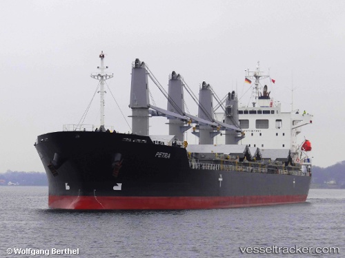
Vessel PETRA IMO: 9597630, MMSI: 538008969 General Cargo Ship
UTC, 23.91301, -84.55396, course: -1, speed: 1.3
UTC, 23.77772, -84.64827, course: -1, speed: 14.1
2026-03-04 22:02:21 UTC, 23.32273, -84.78645, course: -1, speed: 13.3
Live Vessel PETRA Analytics (details, animations, etc.)
Live AIS position: UTC. 58 nm NW of Santa Lucia), updated 2026-03-04 22:02:21 UTC.Find the position of the vessel PETRA on the map. The latter are known coordinates and path.
marine traffic ship tracker show on live map
The current position of vessel PETRA is 23.32273 lat / -84.78645 lng. Updated: 2026-03-04 22:02:21 UTCCurrently sailing under the flag of Marshall Islands
PETRA built in 2011 year
Deadweight:
33688 tDetails:
Last coordinates of the vessel:
UTC, 23.90780, -84.52534, course: 354, speed: 1.3UTC, 23.91301, -84.55396, course: -1, speed: 1.3
UTC, 23.77772, -84.64827, course: -1, speed: 14.1
2026-03-04 22:02:21 UTC, 23.32273, -84.78645, course: -1, speed: 13.3