 vesseltracker.com
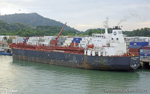
Vessel AQUARIUS T IMO: 9494668, MMSI: 538008978 Chemical/Oil Products Tanker
UTC, 51.31958, 4.31577, course: 156, speed: 0
UTC, 51.31962, 4.31578, course: 155, speed: 0
2026-02-26 13:24:16 UTC, 51.31959, 4.31578, course: 155, speed: 0
Live AIS position:
UTC. Near Berendrecht),
updated 2026-02-26 13:24:16 UTC.
Find the position of the vessel AQUARIUS T on the map. The latter are known coordinates and path.
marine traffic ship tracker show on live map
The current position of vessel AQUARIUS T is 51.31959 lat / 4.31578 lng. Updated: 2026-02-26 13:24:16 UTCCurrently sailing under the flag of Marshall Islands
AQUARIUS T built in 2010 year
Deadweight:
46147 tDetails:
Last coordinates of the vessel:
UTC, 51.31959, 4.31578, course: 156, speed: 0UTC, 51.31958, 4.31577, course: 156, speed: 0
UTC, 51.31962, 4.31578, course: 155, speed: 0
2026-02-26 13:24:16 UTC, 51.31959, 4.31578, course: 155, speed: 0