 vesseltracker.com
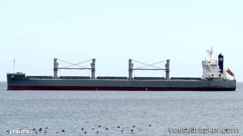
Vessel MOLYVOS LUCK IMO: 9660621, MMSI: 538009090 Bulk Carrier
UTC, 51.38786, 3.71242, course: 149, speed: 9.2
UTC, 51.36859, 4.11604, course: 81, speed: 9.8
2026-02-23 11:35:18 UTC, 51.26379, 4.28461, course: 270, speed: 2.3
Live AIS position:
UTC. Near Kallo),
updated 2026-02-23 11:35:18 UTC.
Find the position of the vessel MOLYVOS LUCK on the map. The latter are known coordinates and path.
marine traffic ship tracker show on live map
The current position of vessel MOLYVOS LUCK is 51.26379 lat / 4.28461 lng. Updated: 2026-02-23 11:35:18 UTCCurrently sailing under the flag of Marshall Islands
MOLYVOS LUCK built in 2014 year
Deadweight:
57924 tDetails:
Last coordinates of the vessel:
UTC, 51.40586, 3.38413, course: 84, speed: 12.6UTC, 51.38786, 3.71242, course: 149, speed: 9.2
UTC, 51.36859, 4.11604, course: 81, speed: 9.8
2026-02-23 11:35:18 UTC, 51.26379, 4.28461, course: 270, speed: 2.3