 vesseltracker.com
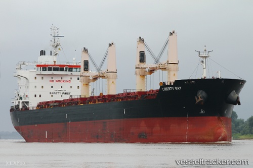
Vessel Liberty Bay IMO: 9522893, MMSI: 538009362 Bulk Carrier
UTC, 53.45466, -3.01450, course: 246, speed: 0
UTC, 53.45469, -3.01450, course: 245, speed: 0
2026-01-14 17:43:45 UTC, 53.45456, -3.01437, course: 242, speed: 0
Live AIS position:
UTC. Near Liverpool),
updated 2026-01-14 17:43:45 UTC.
Find the position of the vessel Liberty Bay on the map. The latter are known coordinates and path.
marine traffic ship tracker show on live map
The current position of vessel Liberty Bay is 53.45456 lat / -3.01437 lng. Updated: 2026-01-14 17:43:45 UTCCurrently sailing under the flag of Marshall Islands
Details:
Last coordinates of the vessel:
UTC, 53.45470, -3.01450, course: 244, speed: 0UTC, 53.45466, -3.01450, course: 246, speed: 0
UTC, 53.45469, -3.01450, course: 245, speed: 0
2026-01-14 17:43:45 UTC, 53.45456, -3.01437, course: 242, speed: 0