 vesseltracker.com
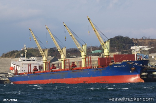
Vessel BLUE CECIL IMO: 9300207, MMSI: 538009420 Bulk Carrier
UTC, -37.65167, 176.18167, course: -1, speed: 0
UTC, -37.65212, 176.18248, course: 8, speed: 0
2026-03-06 21:26:24 UTC, -37.53432, 176.22002, course: 25, speed: 14.1
Live Vessel BLUE CECIL Analytics (details, animations, etc.)
Live AIS position: UTC. Near Tauranga), updated 2026-03-06 21:26:24 UTC.Find the position of the vessel BLUE CECIL on the map. The latter are known coordinates and path.
marine traffic ship tracker show on live map
The current position of vessel BLUE CECIL is -37.53432 lat / 176.22002 lng. Updated: 2026-03-06 21:26:24 UTCCurrently sailing under the flag of Marshall Islands
BLUE CECIL built in 2004 year
Deadweight:
32564 tDetails:
Last coordinates of the vessel:
UTC, -37.65167, 176.18167, course: -1, speed: 0UTC, -37.65167, 176.18167, course: -1, speed: 0
UTC, -37.65212, 176.18248, course: 8, speed: 0
2026-03-06 21:26:24 UTC, -37.53432, 176.22002, course: 25, speed: 14.1