 vesseltracker.com
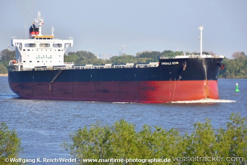
Vessel EOLOS G IMO: 9623738, MMSI: 538009453 Bulk Carrier
UTC, 49.33258, -123.23714, course: -1, speed: 0
UTC, 49.33167, -123.23667, course: -1, speed: 0
2026-03-15 22:04:27 UTC, 49.33392, -123.23652, course: 138, speed: 0.1
Live Vessel EOLOS G Analytics (details, animations, etc.)
Live AIS position: UTC. Near Burrard Inlet), updated 2026-03-15 22:04:27 UTC.Find the position of the vessel EOLOS G on the map. The latter are known coordinates and path.
marine traffic ship tracker show on live map
The current position of vessel EOLOS G is 49.33392 lat / -123.23652 lng. Updated: 2026-03-15 22:04:27 UTCCurrently sailing under the flag of Marshall Islands
EOLOS G built in 2014 year
Deadweight:
81817 tDetails:
Last coordinates of the vessel:
UTC, 49.33250, -123.23699, course: 80, speed: 0UTC, 49.33258, -123.23714, course: -1, speed: 0
UTC, 49.33167, -123.23667, course: -1, speed: 0
2026-03-15 22:04:27 UTC, 49.33392, -123.23652, course: 138, speed: 0.1