 vesseltracker.com
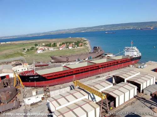
Vessel Azov Coast IMO: 9387736, MMSI: 538009467 General Cargo Ship
UTC, 40.77625, 29.59661, course: 232, speed: 0
UTC, 40.77625, 29.59661, course: 231, speed: 0
2026-01-27 12:03:55 UTC, 40.77624, 29.59662, course: 232, speed: 0
Live AIS position:
UTC. Near HEREKE),
updated 2026-01-27 12:03:55 UTC.
Find the position of the vessel Azov Coast on the map. The latter are known coordinates and path.
marine traffic ship tracker show on live map
The current position of vessel Azov Coast is 40.77624 lat / 29.59662 lng. Updated: 2026-01-27 12:03:55 UTCCurrently sailing under the flag of Marshall Islands
Details:
Last coordinates of the vessel:
UTC, 40.77624, 29.59661, course: 232, speed: 0UTC, 40.77625, 29.59661, course: 232, speed: 0
UTC, 40.77625, 29.59661, course: 231, speed: 0
2026-01-27 12:03:55 UTC, 40.77624, 29.59662, course: 232, speed: 0