 vesseltracker.com
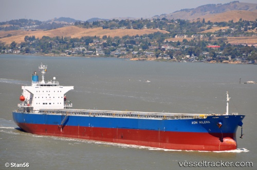
Vessel ATMOSPHERE IMO: 9527283, MMSI: 538009558 Bulk Carrier
UTC, 30.01402, -90.77778, course: 250, speed: 0
UTC, 30.01383, -90.77775, course: 254, speed: 0.1
2026-01-14 07:31:08 UTC, 30.01393, -90.77782, course: 253, speed: 0
Live AIS position:
UTC. Near Saint James Parish),
updated 2026-01-14 07:31:08 UTC.
Find the position of the vessel ATMOSPHERE on the map. The latter are known coordinates and path.
marine traffic ship tracker show on live map
The current position of vessel ATMOSPHERE is 30.01393 lat / -90.77782 lng. Updated: 2026-01-14 07:31:08 UTCCurrently sailing under the flag of Marshall Islands
ATMOSPHERE built in 2009 year
Deadweight:
76606 tDetails:
Last coordinates of the vessel:
UTC, 30.01410, -90.77795, course: 247, speed: 0UTC, 30.01402, -90.77778, course: 250, speed: 0
UTC, 30.01383, -90.77775, course: 254, speed: 0.1
2026-01-14 07:31:08 UTC, 30.01393, -90.77782, course: 253, speed: 0