 vesseltracker.com
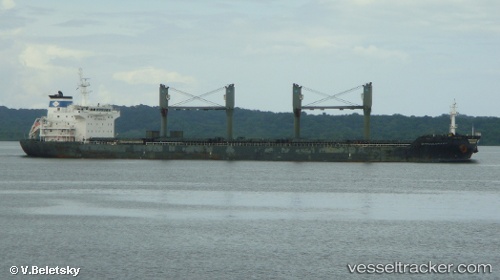
Vessel NORDIC LONDON IMO: 9489974, MMSI: 538009714 Bulk Carrier
UTC, 40.95159, 28.73431, course: 225, speed: 0
UTC, 40.95085, 28.73487, course: 259, speed: 0
2026-01-28 04:10:20 UTC, 40.94993, 28.73486, course: 298, speed: 0
Live AIS position:
UTC. Near Ambarli),
updated 2026-01-28 04:10:20 UTC.
Find the position of the vessel NORDIC LONDON on the map. The latter are known coordinates and path.
marine traffic ship tracker show on live map
The current position of vessel NORDIC LONDON is 40.94993 lat / 28.73486 lng. Updated: 2026-01-28 04:10:20 UTCCurrently sailing under the flag of Marshall Islands
NORDIC LONDON built in 2010 year
Deadweight:
34904 tDetails:
Last coordinates of the vessel:
UTC, 40.95170, 28.73424, course: 223, speed: 0UTC, 40.95159, 28.73431, course: 225, speed: 0
UTC, 40.95085, 28.73487, course: 259, speed: 0
2026-01-28 04:10:20 UTC, 40.94993, 28.73486, course: 298, speed: 0