 vesseltracker.com
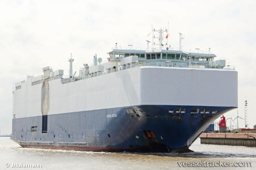
Find the position of the vessel VIKING OCEAN on the map. The latter are known coordinates and path.
marine traffic ship tracker show on live map
The current position of vessel VIKING OCEAN is 22.8272 lat / -167.845 lng. Updated: 2024-05-08 15:56:38 UTCCurrently sailing under the flag of Marshall Islands
VIKING OCEAN built in 2012 year
Deadweight:
12550 tGross tonnage:
39454Service entry:
2012-01-01T00:00:00ZDetails:
Last coordinates of the vessel:
UTC, 22.6325, -166.911, course: 283, speed: 14.7UTC, 22.6793, -167.128, course: 281, speed: 14.8
UTC, 22.7126, -167.296, course: 282, speed: 14.6
2024-05-08 15:56:38 UTC, 22.8272, -167.845, course: 281, speed: 14.1