 vesseltracker.com
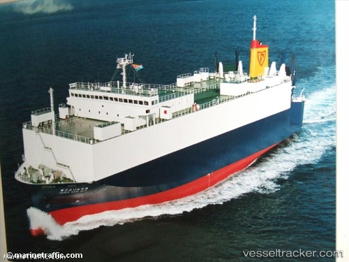
Vessel VIKING PRINCESS IMO: 9136967, MMSI: 538009732 Vehicles Carrier
UTC, 43.31470, 5.36297, course: 237, speed: 0
UTC, 43.31471, 5.36297, course: 237, speed: 0.1
2026-01-19 04:20:43 UTC, 43.31471, 5.36297, course: 237, speed: 0
Live AIS position:
UTC. Near Le Canet),
updated 2026-01-19 04:20:43 UTC.
Find the position of the vessel VIKING PRINCESS on the map. The latter are known coordinates and path.
marine traffic ship tracker show on live map
The current position of vessel VIKING PRINCESS is 43.31471 lat / 5.36297 lng. Updated: 2026-01-19 04:20:43 UTCCurrently sailing under the flag of Marshall Islands
VIKING PRINCESS built in 1996 year
Deadweight:
3995 tDetails:
Last coordinates of the vessel:
UTC, 43.31471, 5.36299, course: 237, speed: 0UTC, 43.31470, 5.36297, course: 237, speed: 0
UTC, 43.31471, 5.36297, course: 237, speed: 0.1
2026-01-19 04:20:43 UTC, 43.31471, 5.36297, course: 237, speed: 0