 vesseltracker.com
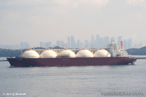
Vessel AL WAKRAH IMO: 9086746, MMSI: 538009770 LNG Tanker
UTC, 21.44199, 119.30480, course: 202, speed: 17.3
UTC, 20.82500, 119.07833, course: -1, speed: 17
2026-02-18 09:34:27 UTC, 20.35333, 118.80667, course: -1, speed: 17
Live AIS position:
UTC. 155 nm NW of Bangui),
updated 2026-02-18 09:34:27 UTC.
Find the position of the vessel AL WAKRAH on the map. The latter are known coordinates and path.
marine traffic ship tracker show on live map
The current position of vessel AL WAKRAH is 20.35333 lat / 118.80667 lng. Updated: 2026-02-18 09:34:27 UTCCurrently sailing under the flag of Marshall Islands
AL WAKRAH built in 1998 year
Deadweight:
72453 tDetails:
Last coordinates of the vessel:
UTC, 21.96261, 119.54435, course: 203, speed: 11.6UTC, 21.44199, 119.30480, course: 202, speed: 17.3
UTC, 20.82500, 119.07833, course: -1, speed: 17
2026-02-18 09:34:27 UTC, 20.35333, 118.80667, course: -1, speed: 17