 vesseltracker.com
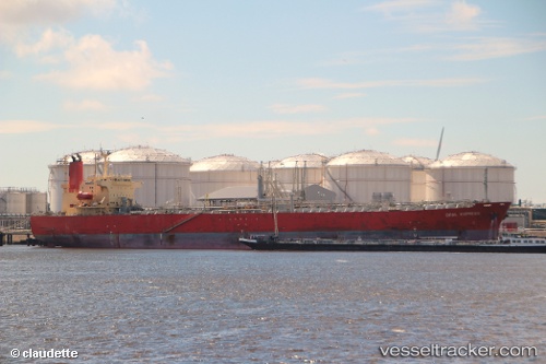
Vessel ANGEL STAR IMO: 9292345, MMSI: 538009781 Oil Products Tanker
UTC, 40.59818, -74.20140, course: 8, speed: 0
UTC, 40.59813, -74.20135, course: 8, speed: 0
2026-01-15 02:17:48 UTC, 40.59808, -74.20140, course: 8, speed: 0
Live AIS position:
UTC. Near Chrome),
updated 2026-01-15 02:17:48 UTC.
Find the position of the vessel ANGEL STAR on the map. The latter are known coordinates and path.
marine traffic ship tracker show on live map
The current position of vessel ANGEL STAR is 40.59808 lat / -74.20140 lng. Updated: 2026-01-15 02:17:48 UTCCurrently sailing under the flag of Marshall Islands
ANGEL STAR built in 2006 year
Deadweight:
48635 tDetails:
Last coordinates of the vessel:
UTC, 40.59818, -74.20140, course: 8, speed: 0UTC, 40.59818, -74.20140, course: 8, speed: 0
UTC, 40.59813, -74.20135, course: 8, speed: 0
2026-01-15 02:17:48 UTC, 40.59808, -74.20140, course: 8, speed: 0