 vesseltracker.com
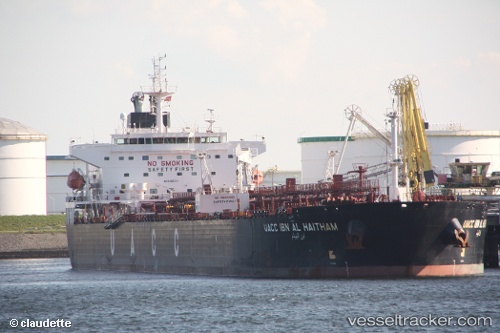
Vessel UOG HARRIET G IMO: 9485631, MMSI: 538009854 Crude Oil Tanker
UTC, 25.18965, 56.36315, course: 0, speed: 0
UTC, 25.18969, 56.36312, course: 0, speed: 0
2026-02-18 07:24:51 UTC, 25.18979, 56.36314, course: 0, speed: 0
Live AIS position:
UTC. Near Al Fujayrah),
updated 2026-02-18 07:24:51 UTC.
Find the position of the vessel UOG HARRIET G on the map. The latter are known coordinates and path.
marine traffic ship tracker show on live map
The current position of vessel UOG HARRIET G is 25.18979 lat / 56.36314 lng. Updated: 2026-02-18 07:24:51 UTCCurrently sailing under the flag of Marshall Islands
UOG HARRIET G built in 2009 year
Deadweight:
73338 tDetails:
Last coordinates of the vessel:
UTC, 25.18966, 56.36316, course: 0, speed: 0UTC, 25.18965, 56.36315, course: 0, speed: 0
UTC, 25.18969, 56.36312, course: 0, speed: 0
2026-02-18 07:24:51 UTC, 25.18979, 56.36314, course: 0, speed: 0