 vesseltracker.com
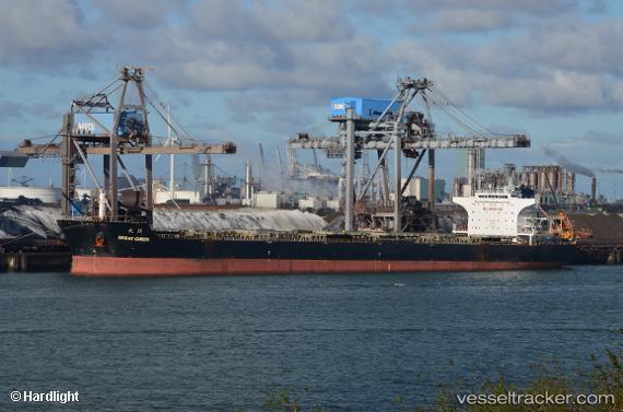
Vessel REACHY SUMMER IMO: 9458755, MMSI: 538010036 Bulk Carrier
UTC, 59.70308, 28.39912, course: 168, speed: 6.1
UTC, 59.68848, 28.42027, course: 175, speed: 0.3
2026-02-09 13:34:26 UTC, 59.68850, 28.42058, course: 182, speed: 0
Live AIS position:
UTC. Near Ust-Luga),
updated 2026-02-09 13:34:26 UTC.
Find the position of the vessel REACHY SUMMER on the map. The latter are known coordinates and path.
marine traffic ship tracker show on live map
The current position of vessel REACHY SUMMER is 59.68850 lat / 28.42058 lng. Updated: 2026-02-09 13:34:26 UTCCurrently sailing under the flag of Marshall Islands
REACHY SUMMER built in 2009 year
Deadweight:
93297 tDetails:
Last coordinates of the vessel:
UTC, 59.85419, 28.42830, course: 213, speed: 0UTC, 59.70308, 28.39912, course: 168, speed: 6.1
UTC, 59.68848, 28.42027, course: 175, speed: 0.3
2026-02-09 13:34:26 UTC, 59.68850, 28.42058, course: 182, speed: 0