 vesseltracker.com
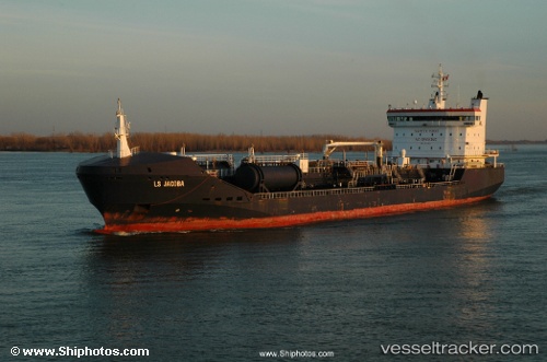
Vessel SEA BAZOU 2 IMO: 9334428, MMSI: 538010078 Chemical/Oil Products Tanker
UTC, 4.05711, 9.69335, course: 34, speed: 0
UTC, 4.05712, 9.69334, course: 34, speed: 0
2026-02-22 17:22:33 UTC, 4.05704, 9.69337, course: 34, speed: 0.1
Live AIS position:
UTC. Near Douala),
updated 2026-02-22 17:22:33 UTC.
Find the position of the vessel SEA BAZOU 2 on the map. The latter are known coordinates and path.
marine traffic ship tracker show on live map
The current position of vessel SEA BAZOU 2 is 4.05704 lat / 9.69337 lng. Updated: 2026-02-22 17:22:33 UTCCurrently sailing under the flag of Marshall Islands
SEA BAZOU 2 built in 2006 year
Deadweight:
15551 tDetails:
Last coordinates of the vessel:
UTC, 4.05712, 9.69331, course: 34, speed: 0UTC, 4.05711, 9.69335, course: 34, speed: 0
UTC, 4.05712, 9.69334, course: 34, speed: 0
2026-02-22 17:22:33 UTC, 4.05704, 9.69337, course: 34, speed: 0.1