 vesseltracker.com
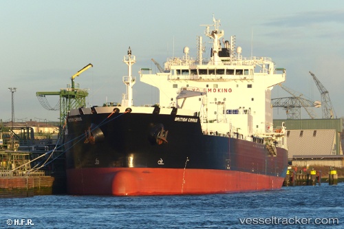
Vessel SEA CIRRUS IMO: 9724568, MMSI: 538010128 Chemical/Oil Products Tanker
UTC, 52.40561, 4.82751, course: 269, speed: 0
UTC, 52.40561, 4.82752, course: 270, speed: 0
2026-02-03 09:48:48 UTC, 52.40561, 4.82751, course: 270, speed: 0
Live AIS position:
UTC. Near ZAANDAM),
updated 2026-02-03 09:48:48 UTC.
Find the position of the vessel SEA CIRRUS on the map. The latter are known coordinates and path.
marine traffic ship tracker show on live map
The current position of vessel SEA CIRRUS is 52.40561 lat / 4.82751 lng. Updated: 2026-02-03 09:48:48 UTCCurrently sailing under the flag of Marshall Islands
SEA CIRRUS built in 2017 year
Deadweight:
39999 tDetails:
Last coordinates of the vessel:
UTC, 52.40561, 4.82751, course: 269, speed: 0UTC, 52.40561, 4.82751, course: 269, speed: 0
UTC, 52.40561, 4.82752, course: 270, speed: 0
2026-02-03 09:48:48 UTC, 52.40561, 4.82751, course: 270, speed: 0