 vesseltracker.com
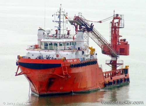
Vessel ASTRO ARCTURUS IMO: 9500871, MMSI: 538010205 Utility Vessel
UTC, 25.46925, 55.50862, course: 119, speed: 0
UTC, 25.46924, 55.50861, course: 119, speed: 0
2026-01-18 00:10:19 UTC, 25.46922, 55.50861, course: 119, speed: 0
Live AIS position:
UTC. Near Al Hamriyah),
updated 2026-01-18 00:10:19 UTC.
Find the position of the vessel ASTRO ARCTURUS on the map. The latter are known coordinates and path.
marine traffic ship tracker show on live map
The current position of vessel ASTRO ARCTURUS is 25.46922 lat / 55.50861 lng. Updated: 2026-01-18 00:10:19 UTCCurrently sailing under the flag of Marshall Islands
ASTRO ARCTURUS built in 2010 year
Deadweight:
1624 tDetails:
Last coordinates of the vessel:
UTC, 25.46922, 55.50862, course: 119, speed: 0UTC, 25.46925, 55.50862, course: 119, speed: 0
UTC, 25.46924, 55.50861, course: 119, speed: 0
2026-01-18 00:10:19 UTC, 25.46922, 55.50861, course: 119, speed: 0