 vesseltracker.com
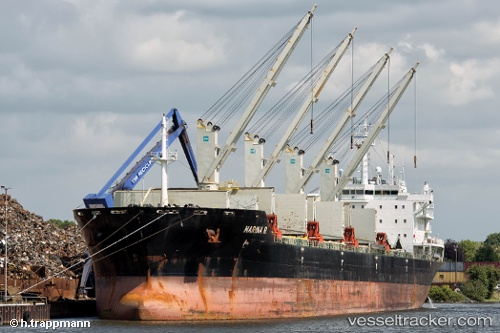
Vessel MARINA R IMO: 9409546, MMSI: 538011257 Bulk Carrier
UTC, 49.08333, 140.27333, course: -1, speed: 0
UTC, 49.08333, 140.27333, course: -1, speed: 0
2026-03-12 21:28:53 UTC, 49.08333, 140.27333, course: -1, speed: 0
Live Vessel MARINA R Analytics (details, animations, etc.)
Live AIS position: UTC. Near Vanino), updated 2026-03-12 21:28:53 UTC.Find the position of the vessel MARINA R on the map. The latter are known coordinates and path.
marine traffic ship tracker show on live map
The current position of vessel MARINA R is 49.08333 lat / 140.27333 lng. Updated: 2026-03-12 21:28:53 UTCCurrently sailing under the flag of Marshall Islands
Details:
Last coordinates of the vessel:
UTC, 49.08333, 140.27333, course: -1, speed: 0UTC, 49.08333, 140.27333, course: -1, speed: 0
UTC, 49.08333, 140.27333, course: -1, speed: 0
2026-03-12 21:28:53 UTC, 49.08333, 140.27333, course: -1, speed: 0