 vesseltracker.com
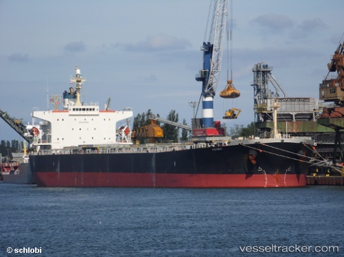
Vessel ARCTURUS I IMO: 9221334, MMSI: 538012228 Bulk Carrier
UTC, 31.37642, 121.69045, course: 119, speed: 0
UTC, 31.37645, 121.69047, course: 119, speed: 0
2026-02-28 17:23:54 UTC, 31.37645, 121.69048, course: 119, speed: 0
Live AIS position:
UTC. Near Gonglu),
updated 2026-02-28 17:23:54 UTC.
Find the position of the vessel ARCTURUS I on the map. The latter are known coordinates and path.
marine traffic ship tracker show on live map
The current position of vessel ARCTURUS I is 31.37645 lat / 121.69048 lng. Updated: 2026-02-28 17:23:54 UTCCurrently sailing under the flag of Marshall Islands
Details:
Last coordinates of the vessel:
UTC, 31.37640, 121.69051, course: 119, speed: 0UTC, 31.37642, 121.69045, course: 119, speed: 0
UTC, 31.37645, 121.69047, course: 119, speed: 0
2026-02-28 17:23:54 UTC, 31.37645, 121.69048, course: 119, speed: 0