 vesseltracker.com
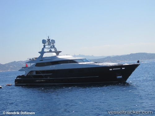
Vessel TIAMAT IMO: 9583079, MMSI: 538072087 Yacht
UTC, 43.69759, 7.28432, course: 105, speed: 0
UTC, 43.69758, 7.28432, course: 105, speed: 0
2026-02-22 19:31:43 UTC, 43.69760, 7.28433, course: 105, speed: 0
Live AIS position:
UTC. Near Nice),
updated 2026-02-22 19:31:43 UTC.
Find the position of the vessel TIAMAT on the map. The latter are known coordinates and path.
marine traffic ship tracker show on live map
The current position of vessel TIAMAT is 43.69760 lat / 7.28433 lng. Updated: 2026-02-22 19:31:43 UTCCurrently sailing under the flag of Marshall Islands
Details:
Last coordinates of the vessel:
UTC, 43.69760, 7.28432, course: 105, speed: 0UTC, 43.69759, 7.28432, course: 105, speed: 0
UTC, 43.69758, 7.28432, course: 105, speed: 0
2026-02-22 19:31:43 UTC, 43.69760, 7.28433, course: 105, speed: 0