 vesseltracker.com
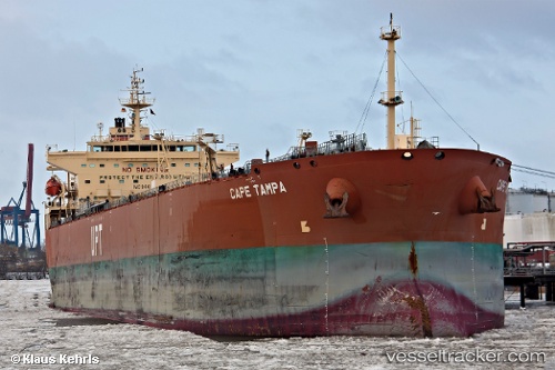
Vessel Cape Tampa IMO: 9441166, MMSI: 538090382 Crude Oil Tanker
UTC, 17.69751, -64.75327, course: 155, speed: 0
UTC, 17.69747, -64.75323, course: 155, speed: 0
2026-01-27 21:32:03 UTC, 17.69744, -64.75325, course: 155, speed: 0
Live AIS position:
UTC. Near ST CROIX),
updated 2026-01-27 21:32:03 UTC.
Find the position of the vessel Cape Tampa on the map. The latter are known coordinates and path.
marine traffic ship tracker show on live map
The current position of vessel Cape Tampa is 17.69744 lat / -64.75325 lng. Updated: 2026-01-27 21:32:03 UTCDetails:
Last coordinates of the vessel:
UTC, 17.69745, -64.75327, course: 155, speed: 0UTC, 17.69751, -64.75327, course: 155, speed: 0
UTC, 17.69747, -64.75323, course: 155, speed: 0
2026-01-27 21:32:03 UTC, 17.69744, -64.75325, course: 155, speed: 0