 vesseltracker.com
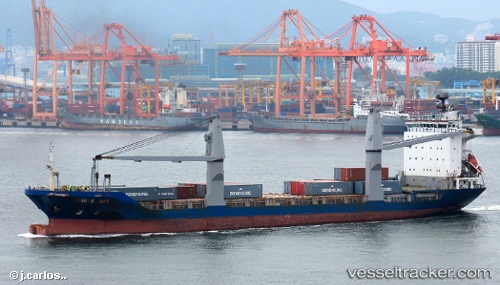
Vessel OCEAN HUMILITY IMO: 9161819, MMSI: 548581900 Container Ship
UTC, 10.68504, 122.93399, course: -1, speed: 0
UTC, 10.68503, 122.93397, course: -1, speed: 0
2026-03-14 17:54:21 UTC, 10.68504, 122.93398, course: -1, speed: 0
Live Vessel OCEAN HUMILITY Analytics (details, animations, etc.)
Live AIS position: UTC. Near BACOLOD), updated 2026-03-14 17:54:21 UTC.Find the position of the vessel OCEAN HUMILITY on the map. The latter are known coordinates and path.
marine traffic ship tracker show on live map
The current position of vessel OCEAN HUMILITY is 10.68504 lat / 122.93398 lng. Updated: 2026-03-14 17:54:21 UTCCurrently sailing under the flag of Philippines
Details:
Last coordinates of the vessel:
UTC, 10.68505, 122.93397, course: -1, speed: 0UTC, 10.68504, 122.93399, course: -1, speed: 0
UTC, 10.68503, 122.93397, course: -1, speed: 0
2026-03-14 17:54:21 UTC, 10.68504, 122.93398, course: -1, speed: 0