 vesseltracker.com
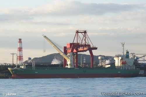
Vessel WHITE INABA IMO: 9670169, MMSI: 548676000 General Cargo Ship
UTC, 3.97139, 103.42728, course: 70, speed: 0
UTC, 3.97143, 103.42731, course: 70, speed: 0
2026-02-22 04:23:04 UTC, 3.97142, 103.42730, course: 70, speed: 0
Live AIS position:
UTC. Near Gebeng),
updated 2026-02-22 04:23:04 UTC.
Find the position of the vessel WHITE INABA on the map. The latter are known coordinates and path.
marine traffic ship tracker show on live map
The current position of vessel WHITE INABA is 3.97142 lat / 103.42730 lng. Updated: 2026-02-22 04:23:04 UTCCurrently sailing under the flag of Philippines
WHITE INABA built in 2013 year
Deadweight:
13946 tDetails:
Last coordinates of the vessel:
UTC, 3.97141, 103.42731, course: 70, speed: 0.1UTC, 3.97139, 103.42728, course: 70, speed: 0
UTC, 3.97143, 103.42731, course: 70, speed: 0
2026-02-22 04:23:04 UTC, 3.97142, 103.42730, course: 70, speed: 0