 vesseltracker.com
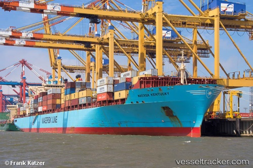
Vessel Maersk Kentucky IMO: 9193240, MMSI: 563073800 Container Ship
UTC, 17.98170, 61.23053, course: 80, speed: 13.8
UTC, 17.98170, 61.23053, course: 80, speed: 13.8
2026-01-31 13:40:09 UTC, 18.29332, 62.85829, course: 78, speed: 13.6
Live AIS position:
UTC. 261 nm SE of Masirah),
updated 2026-01-31 13:40:09 UTC.
Find the position of the vessel Maersk Kentucky on the map. The latter are known coordinates and path.
marine traffic ship tracker show on live map
The current position of vessel Maersk Kentucky is 18.29332 lat / 62.85829 lng. Updated: 2026-01-31 13:40:09 UTCDetails:
Last coordinates of the vessel:
UTC, 17.98170, 61.23053, course: 80, speed: 13.8UTC, 17.98170, 61.23053, course: 80, speed: 13.8
UTC, 17.98170, 61.23053, course: 80, speed: 13.8
2026-01-31 13:40:09 UTC, 18.29332, 62.85829, course: 78, speed: 13.6