 vesseltracker.com
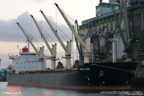
Vessel Ince Ege IMO: 9436733, MMSI: 563088200 Bulk Carrier
UTC, 22.17019, 114.10982, course: 95, speed: 0
UTC, 22.17043, 114.10987, course: 106, speed: 0
2026-01-28 10:20:42 UTC, 22.16989, 114.10986, course: 88, speed: 0.1
Live AIS position:
UTC. Near Pok Fu Lam),
updated 2026-01-28 10:20:42 UTC.
Find the position of the vessel Ince Ege on the map. The latter are known coordinates and path.
marine traffic ship tracker show on live map
The current position of vessel Ince Ege is 22.16989 lat / 114.10986 lng. Updated: 2026-01-28 10:20:42 UTCCurrently sailing under the flag of Singapore
Ince Ege built in 2010 year
Deadweight:
57373 tDetails:
Last coordinates of the vessel:
UTC, 22.17043, 114.10982, course: 108, speed: 0.1UTC, 22.17019, 114.10982, course: 95, speed: 0
UTC, 22.17043, 114.10987, course: 106, speed: 0
2026-01-28 10:20:42 UTC, 22.16989, 114.10986, course: 88, speed: 0.1